
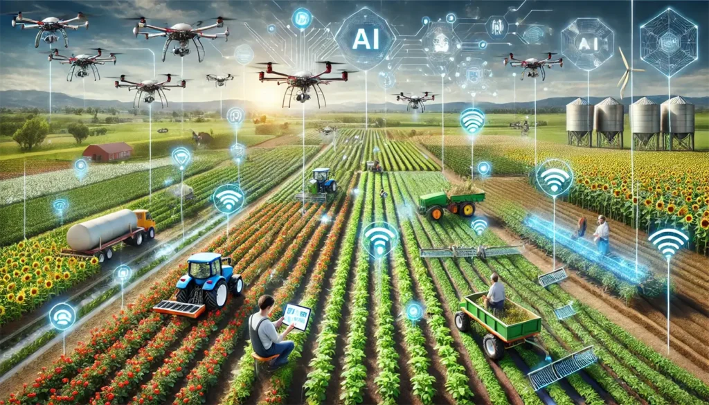
Smart Drone Solutions with AI
At Halkin Inc, we integrate cutting-edge Artificial Intelligence (AI) into our drone services, enhancing precision, efficiency, and insights across all surveying and inspection operations. From photogrammetry to GIS mapping and LiDAR data processing, AI enables us to deliver smarter, faster, and more accurate results for our clients. To support these advanced capabilities, we have dedicated AI specialists on our team with hands-on experience in Artificial Intelligence, Machine Learning, and Deep Learning. Their expertise in intelligent system development, data preprocessing, model training, and automation ensures that every project benefits from robust, data-driven analysis and state-of-the-art AI innovation.
Our Services
AI in Photogrammetry
Our AI-powered photogrammetry workflows transform aerial imagery into highly detailed 2D and 3D maps. AI algorithms automate image alignment, stitching, and point cloud generation, drastically reducing manual processing time while improving accuracy. The result is precise, high-resolution models suitable for planning, monitoring, and analysis.
AI-Driven Lidar Data
AI accelerates the processing of Lidar point clouds, automatically identifying ground surfaces, vegetation, and structural features. This reduces errors and ensures detailed 3D models for topographical surveys, construction monitoring, and asset management—all with faster turnaround times.
AI in GIS Mapping
By integrating AI with Geographic Information Systems (GIS), we can analyze complex spatial data more efficiently. AI helps detect patterns, classify land features, and identify changes over time, providing actionable insights for urban planning, environmental monitoring, and infrastructure management.
AI-Powered Drone Data Processing
Develop and deploy machine learning and deep learning models to analyze aerial data (RGB, LiDAR, thermal, multispectral). Automate object detection, damage assessment, terrain modeling, and infrastructure inspections using AI.
Smart Mapping & 3D Reconstruction
Use AI-enhanced workflows to create 3D models, point clouds, orthomosaics, DSM/DTM, and mesh reconstruction. Improve accuracy by applying AI denoising, point cloud classification, and automatic feature extraction.
Real-Time Inspection & Automation
Build AI tools that allow drones to autonomously identify issues such as cracks, corrosion, missing components, vegetation encroachment, and safety hazards. Integrate computer vision for real-time tracking and automated decision-making during drone missions.
Cesium 3D & Web GIS Integration
Integrate AI-processed drone data into CesiumJS, creating interactive 3D environments. Build systems where users can click any building or area to view AI-generated analytics, photos, or inspection summaries.
Industry-Specific AI Solutions
Oil & Gas: Pipeline monitoring, leak detection, structural integrity analysis
Construction: Progress monitoring, automated volume calculations, safety compliance tracking
Utilities: Powerline inspections, vegetation risk scoring
Agriculture: Crop health detection using AI and multispectral imaging
Real Estate / Smart Cities: 3D city modeling with automated feature extraction
AI Workflow Automation
Create fully automated pipelines from drone capture → AI processing → reporting/dashboard.
Build cloud-based systems for batch processing large datasets.
Predictive Analytics
Use AI models to forecast equipment failure, structural degradation, and maintenance needs based on drone-collected data.
Software Development and Interation
Develop custom tools using Python, TensorFlow, PyTorch, OpenCV, Cesium, and GIS frameworks. Integrate AI solutions with enterprise dashboards, APIs, and cloud infrastructure.
QA, Accuracy Validation, & Reporting
Ensure data accuracy using AI-assisted ground truthing, error correction, and metadata analysis.
Generate AI-backed technical reports for clients.
Innovation & R&D
Research new AI methods to improve drone autonomy, mapping precision, and intelligent analytics.
Develop proprietary algorithms for Smart Drone Solutions under Halkin Inc.
Benefits of AI Integration
Faster Processing
AI reduces manual work, delivering results in a fraction of the traditional time.
Higher Accuracy
Automated algorithms minimize errors in mapping, modeling, and analysis.
Predictive Insights
AI can highlight potential issues or changes in assets before they become critical.
Cost Efficiency
Streamlined workflows save both time and resources while maintaining quality.
Reach out to get our services
From materials inspection to scale rendered mapping and land analysis, Halkin’s certified technicians and software engineers provide customers with concise and expedient reporting and training through a conjunct GIS software platform.