
Drone and Data Services
What is Drone Mapping
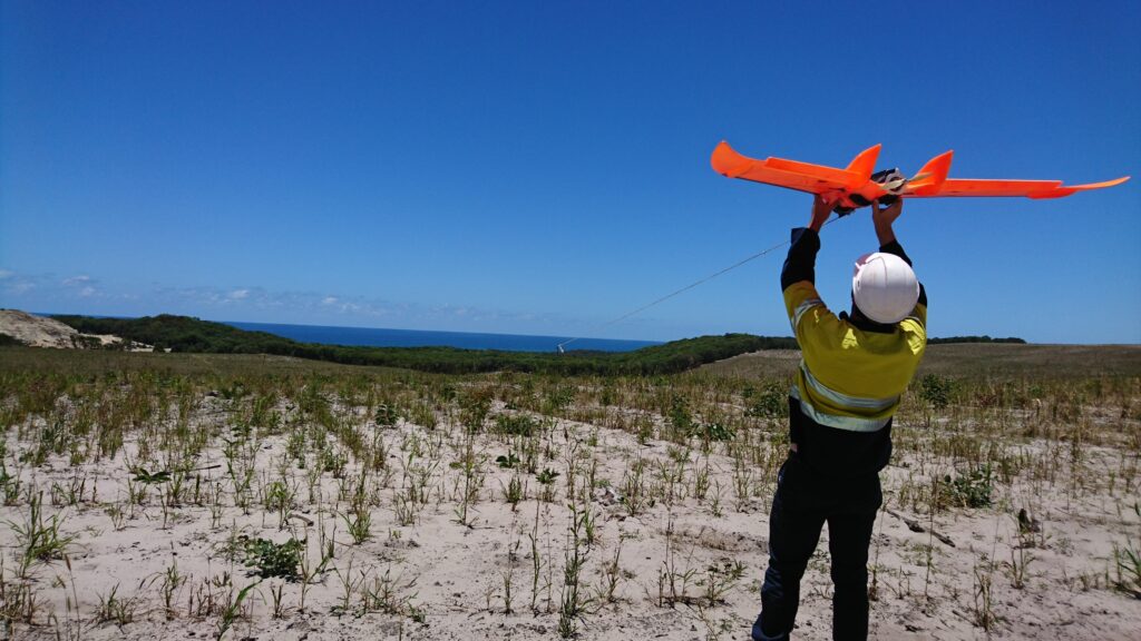
Drone mapping is a cutting-edge technique that uses advanced survey drones to capture aerial images and generate highly detailed maps and models. This modern approach has transformed the way data is gathered, analyzed, and applied across a wide range of industries.
At the heart of drone mapping is its capability to collect precise aerial imagery of land surfaces, structures, and large project sites. Equipped with high-resolution cameras, drones capture overlapping images from multiple angles, allowing vast areas to be surveyed quickly, safely, and with exceptional accuracy.
Drone survey mapping extends far beyond simple aerial photography. The captured images are processed through specialized software to produce accurate maps, 3D models, and digital surface representations. These outputs support critical tasks such as land surveying, construction planning, infrastructure inspection, agriculture management, and environmental assessment. We also use NDVI technology to measure plant health.
Drone mapping is a highly advanced method that elevates aerial data collection, providing precise measurements and detailed visualizations for professional survey needs. At Halkin Inc. our expertise in drone mapping ensures clients receive accurate, efficient, and comprehensive data—empowering smarter decisions and more effective project management.
Our Drone Fleets
Enterprise-Grade Drones for Every Mission
Name
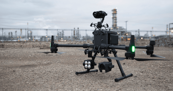
DJI Matrice 300 (M300 RTK)
Purpose:
Industrial inspection & large-area mapping
Key Capabilities:
Long-range, high-endurance flight performance
RTK positioning for centimeter-level accuracy
Supports multiple payloads (RGB, thermal, LiDAR)
Designed for complex and hazardous environment response
DJI Phantom 4 (P4 RTK)
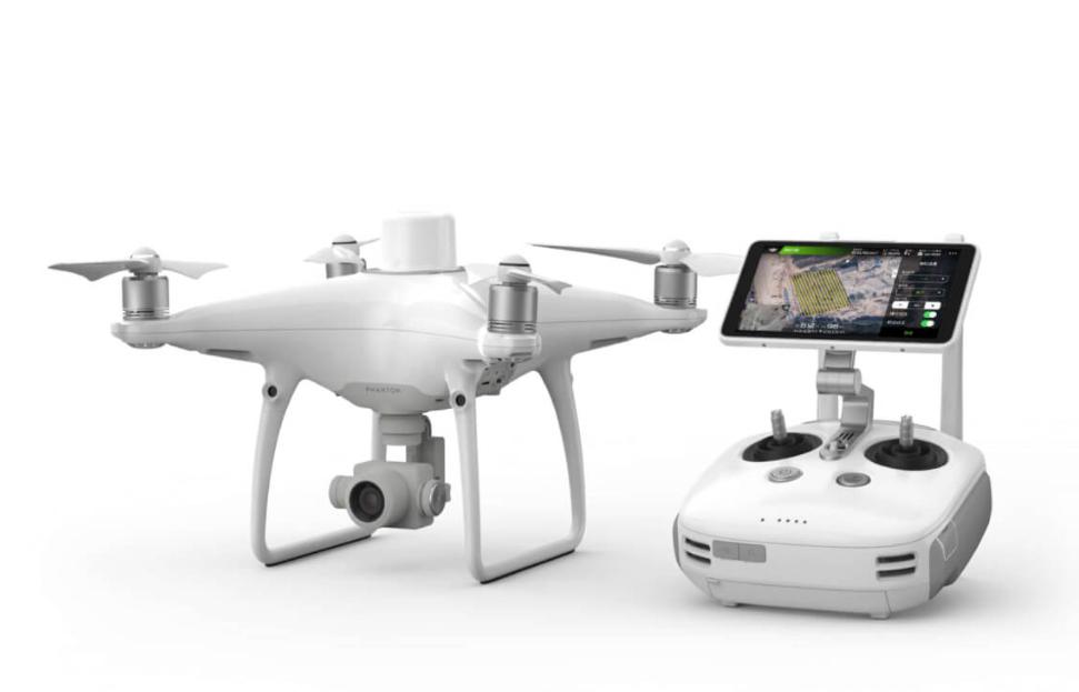
Name
DJI Phantom 4(P4 RTK)
Purpose:
High-precision surveying & mapping
Key Capabilities:
Integrated RTK module for survey-grade accuracy
High-resolution imaging sensor
Efficient deployment for rapid data capture
DJI AGRAS Series
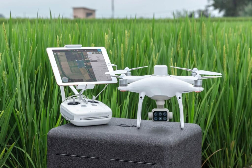
Name
DJI Agras Series
Purpose:
Agricultural & Payload Operations Drone
Key Capabilities:
High-capacity liquid tank for precision spraying operations
Advanced radar and obstacle avoidance for low-altitude flight
Centimeter-level positioning with high-accuracy navigation
Designed for large-area coverage with efficient flight planning
Industrial-grade airframe for demanding environmental conditions
Supports NDVI-based crop analysis for vegetation health assessment and data-driven treatment
Our Partnership
Halkin Inc. and Khalid Al Raddadi Surveying have entered into a strategic partnership to deliver advanced geospatial, surveying, and digital infrastructure solutions across the Kingdom of Saudi Arabia.
Our Joint Services
- Together, the partners provide end-to-end solutions including:
- Land and infrastructure surveying
- Geospatial data collection and analysis
- GIS mapping and spatial intelligence
- UAV / drone-based data acquisition
- Photogrammetry and LiDAR solutions
- 3D modeling and digital twin development
- CAD drawings and technical documentation
Reach out to get our services
From materials inspection to scale rendered mapping and land analysis, Halkin’s certified technicians and software engineers provide customers with concise and expedient reporting and training through a conjunct GIS software platform.